
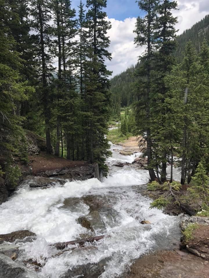
Alpine Loop to Lake City (Corkscrew Gulch, California Pass, Animas Forks, Cinnamon Pass, Lake City, Engineer Pass, Silverton)
- Trail Difficulty: Easy
- Trail Length: 64 miles
- Trail Duration: 6 hours
The Alpine Loop – Engineer and Cinnamon Passes – is one of the longest continuous trail runs in the area. Odom Point gives 360-degree views well above tree line. Both Engineer and Cinnamon Passes top out over 12,000 feet, giving great views. Spend time at Animas Forks ghost town, walking around homes from the original residents and a large mine from the 1910’s.
Photo credit: Connor Corrigan & Colin Finigan
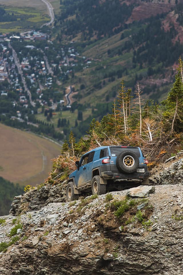
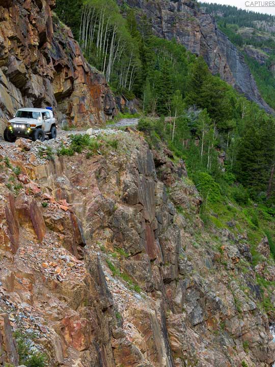
Black Bear Pass (Black Bear Pass, Telluride, Ophir Pass)
- Trail Difficulty: Medium
- Trail Length: 9 miles
- Trail Duration: 4 hours
Not for the faint of heart, Black Bear is one of the most popular but also most dangerous trails in Colorado. Descend 1800 feet in 12 turns down the mountain as you work your way into Telluride. Bridal Veil Falls and Power Station make for great photos along the way.
Photo credit: Caroline Craigmyle & Carrie Nelson

Imogene Pass (Imogene Pass, Telluride, Ophir Pass)
- Trail Difficulty: Medium
- Trail Length: 14 miles
- Trail Duration: 4 hours
With a summit of 13,114 feet, Imogene Pass is one of the highest drivable roads in Colorado. It’s also one of the most beautiful, with natural sights from wildflowers to waterfalls. The pass road goes through Tomboy mining town, operated until 1928 as one of the largest mining complexes in Colorado.
Photo credit: Jessica Larson
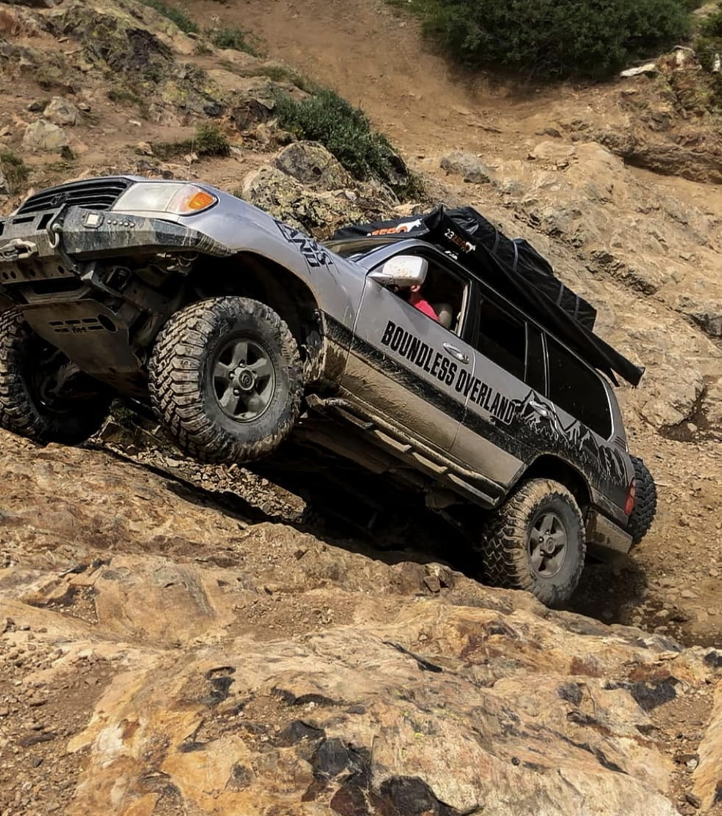
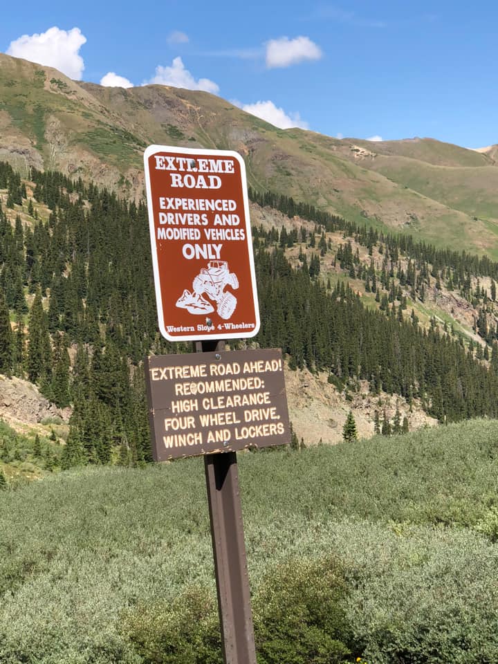
Poughkeepsie Gulch
- Trail Difficulty: Hard
- Trail Length: 14 miles
- Trail Duration: 4 hours
Poughkeepsie Gulch is for the technical offroaders with something to prove. By far the most (in)famous off-highway obstacle in the San Juans, Poughkeepsie Gulch’s wall will challenge your departure and breakover angles as you put your entire vehicle on a steep climb up solid rock. Winch not required…until you need to be pulled up.
Photo credit: Nick Hanke
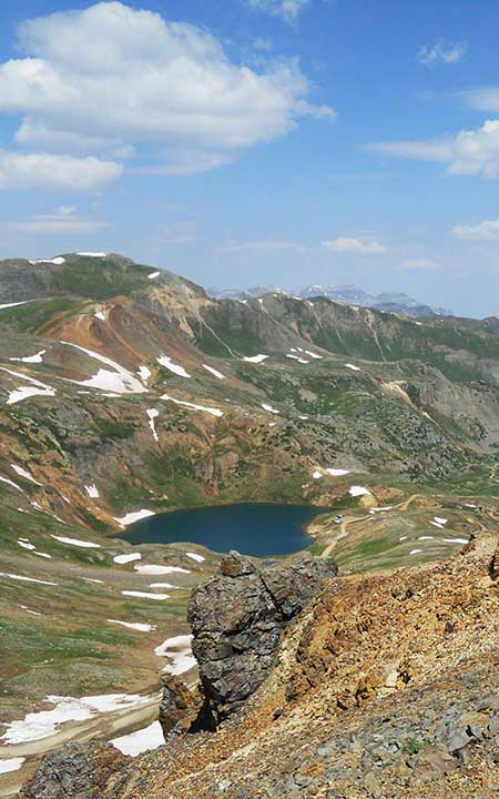
California Pass to Animas Forks (Mineral Creek, Animas Forks, California Pass, Corkscrew Gulch)
- Trail Difficulty: Medium
- Trail Length: 22 miles
- Trail Duration: 5 hours
The California Pass loop is an easy 22 miles of amazing scenery and time to spend at Animas Forks ghost town. At almost 13,000 feet, the top of California Pass has a great view of Como Lake before heading down Corkscrew Gulch to Ironton.
Photo credit: The Great Jack Bottorf
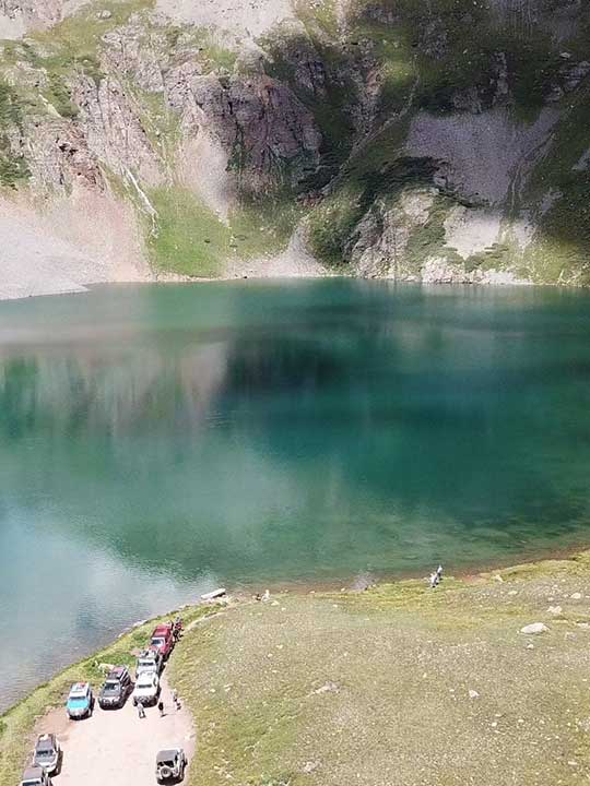
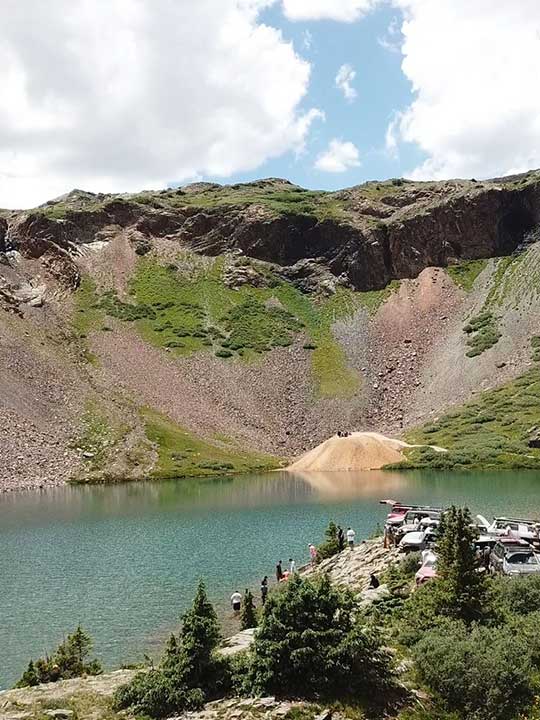
The Lakes -- Bullion King Lake & Clear Lake
- Trail Difficulty: Easy
- Trail Length: 12 miles
- Trail Duration: 5 hours
Enjoy two of the area’s most accessible scenic lakes – Bullion King Lake is a short hike – and take in the clear skies and cold water. These are two of our best destinations for great photos in the San Juans.
Photo credit: James Buff
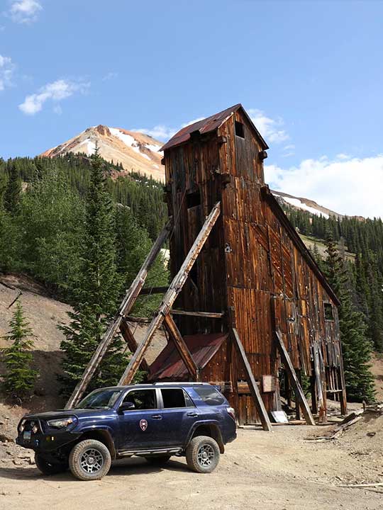
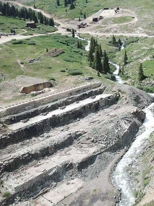
The Mines – Red Mountain Mining District & US Basin
- Trail Difficulty: Easy
- Trail Length: 10 miles
- Trail Duration: 4 hours
The Red Mountain Mining District has some of the most dense and best preserved mining structures in all of Colorado. You will get to explore these structures on foot and see how the miners worked and lived in this silver boom area of the late 1800’s.
Photo credit: Aaron Botnick
Animas Forks via Picayune Gulch (Corkscrew Gulch, California Pass, Picayune Gulch, Animas Forks, Silverton)
- Trail Difficulty: Easy
- Trail Length: 25 miles
- Trail Duration: 5 hours
This shortened version of our Alpine Loop route takes you through the high alpine tundra of Picayune Gulch before arriving at Animas Forks, one of the highest elevation mining camps in North America. Animas Forks had over 400 residents in the 1880’s (nearly half of Ouray’s present population) where you can walk through the houses where they lived and the mines where they worked.
Photo credit: Aaron Botnick
Stony Pass to Kite Lake
- Trail Difficulty: Easy
- Trail Length: 30 miles
- Trail Duration: 6 hours
As you traverse Stony Pass southeast of Silverton, watch out for the herds of sheep and don’t pet the sheep dogs! This trail takes you next to and through the head waters of the Rio Grande river, then up to one of the most remote destinations in the San Juans, Kite Lake.
Photo credit: James Buff